Friends of Joyner Library Maps and Prints
The Friends of Joyner Library have made available prints of historic maps depicting 18th century eastern North Carolina. Please contact us if you are interested in purchasing any of these unique prints.
ECU Wright Building Print
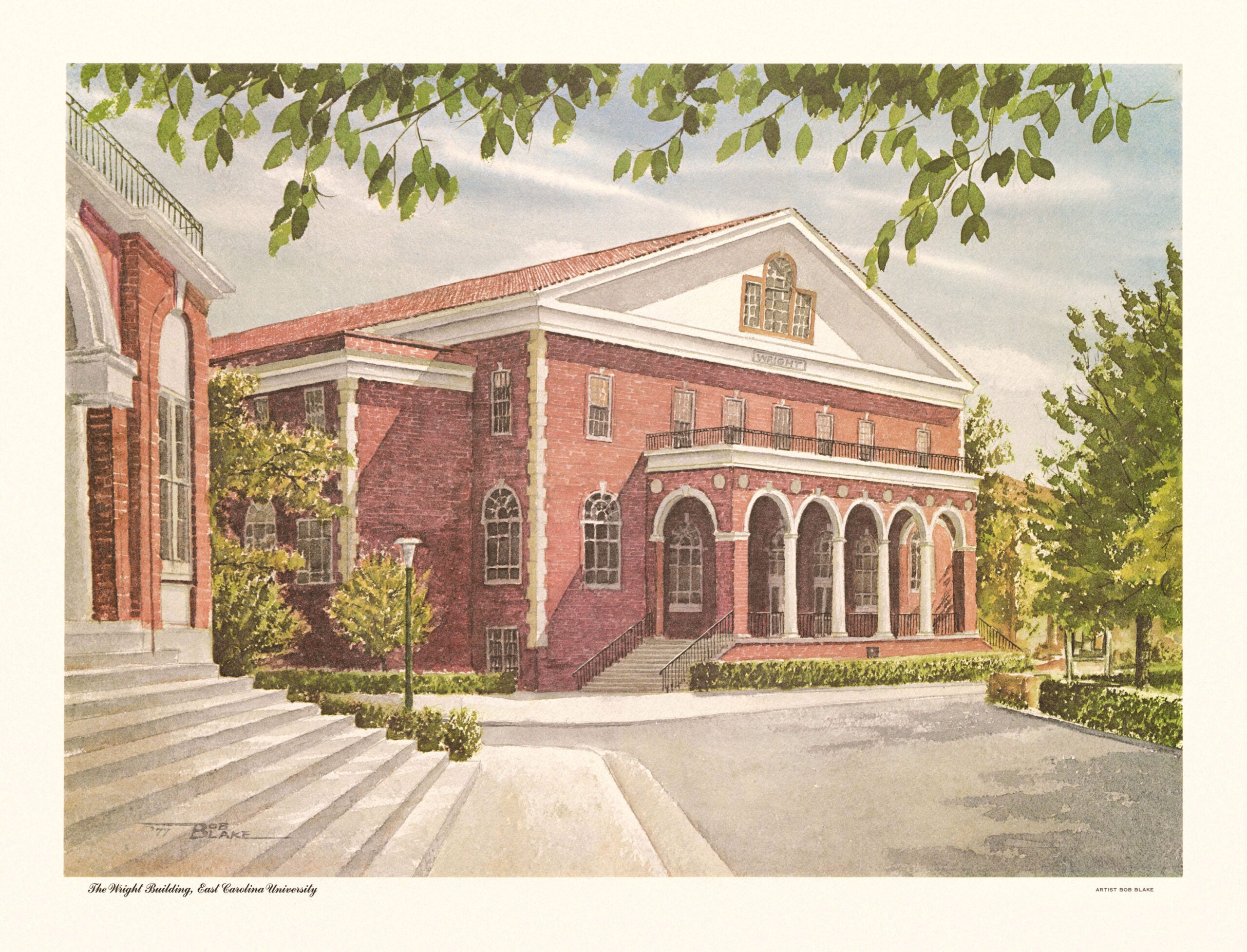
Built in 1937 and an historic landmark in the heart of East Carolina University campus, Wright Auditorium regularly hosts important events such as symphonies, plays, dance performances, graduation and other ceremonies. The building has been renovated twice, most recently in 1981. This painting of Wright Auditorium was created by artist Bob Blake in 1977. Blake worked as a campus and medical illustrator at Duke University. He also enjoyed painting and drawing scenes throughout North Carolina.
The print measures 21”x17”and costs $25.00. All proceeds go to the Friends of Joyner Library. A limited number of these prints are available for sale.
Print cost $25
The Edward Moseley Map – 1733
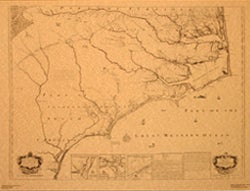
A New and Correct Map of the Province of North Carolina contains the first detailed and accurate survey of the North Carolina coast and its northern boundary with Virginia. It was created by North Carolina’s Surveyor General, Edward Moseley, and engraved in 1733 by John Cowley of London.
The map extends from Cape Carteret to part of Virginia. It includes the names of many settlers and plantations, particularly along waterways including the Albemarle Sound and the Neuse and Pamlico Rivers. East Carolina University’s copy is notable for the additional names of settlers and land features that were added by an early owner. It influenced later maps of the state, including the 1738 Wimble map, the 1770 Collet map and the 1775 Mouzon map.
This colonial era wall map is quite large, spanning almost 5 feet wide by 4 feet high. From the start, it was intended as a luxury item. The printing was expensive, and the edition would have been very limited in size.
ECU’s Moseley Map is the only known original print of this historic map currently extant in the U.S.; two copies are in the United Kingdom, at Eton College and the National Archives. This copy, which disappeared from public view during the mid-nineteenth century, was donated to East Carolina University by Mrs. John W. Graham of Edenton, North Carolina.
The map measures 26 x 33 inches and is available in a black and white or a colorized version. A brief description of the map and a list of family names that appear it are included with the print. Sale proceeds benefit the Friends of Joyner Library.
Print cost $25
Purchase Black and White Version Purchase Colorized Version
The Henry Mouzon Jr. Map – 1775
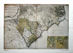
The Mouzon Map (1775) depicts North and South Carolina along with parts of Georgia and Indian Territories (now Tennessee). The map shows geographic land formations of the region, including the mountains, rivers, swamps, marshes, bays, creeks, harbors, and sandbars along the coast. Because it was extensively used by American, British, and French military, it is sometimes called the Revolutionary War map of North and South Carolina.
Although evidence remains inconclusive, it is assumed the author of the map to be Henry Mouzon of St. Stephens’s Parish, Craven County, the son of Henry Mouzon Jr.
The print measures 25 x 33 inches, contains some color, and costs $25.00. All proceeds go to the Friends of Joyner Library.
Print cost $25
Bob Pittman Print of “Harbor Reflections”
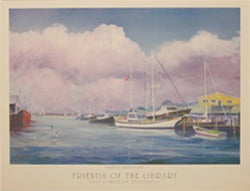
This print depicts a scene from Oriental, North Carolina. The oil painting “Harbor Reflections” by Bob Pittman is displayed at Joyner Library, in the Pirate Tutoring Area.
The painting “Harbor Reflections” was done by Bob Pittman, a well-known local artist, specifically for the Friends of Joyner Library. A limited number of these prints are available for sale.
The print measures 18 x 24 inches and costs $25.00. All proceeds go to the Friends of Joyner Library.
Print Cost $25